TU Ilmenau/Dr. Uwe Holzbecher
At this point we offer you
for different purposes. Most plans are available in both color and black and white. The file format used is PDF. If you need other file formats, please refer to the FAQ.
Please pay attention: Only the current site plans provided here should be used. The site plans are updated at irregular intervals. Modifications for marking purposes such as circles, arrows, colouring or additional labelling by the structural units are permitted, but require the structural unit itself to adapt these modified plans on the basis of the updated site plans after each update of the site plans. If you use such modified plans on your pages, please inform the contact person mentioned above. He will inform you about future updates.
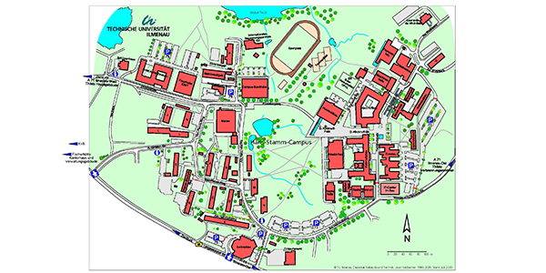
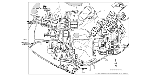
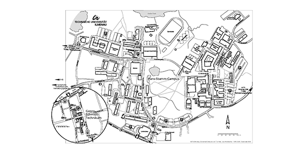
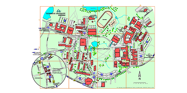
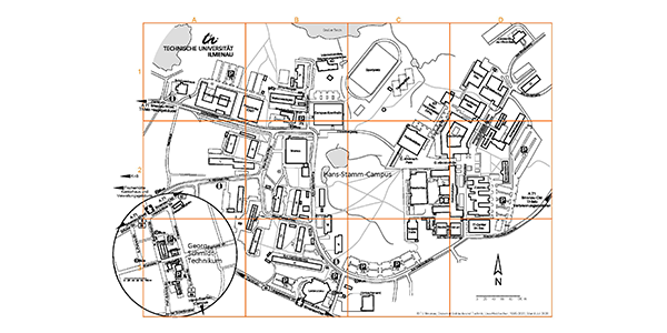
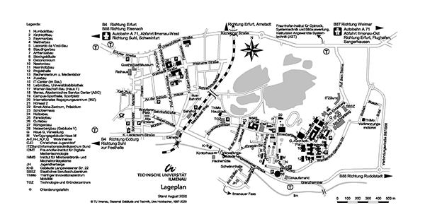
Plan of the Hans-Stamm campus on the Ehrenberg in Ilmenau combined with plan of the Georg-Schmidt-Technikum in Ilmenau
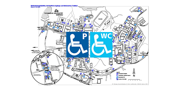
The campus map with information for people with disabilities should help them to find their way around the campus. For this purpose, the location of disabled parking spaces, barrier-free access to the buildings and existing disabled toilets are shown.
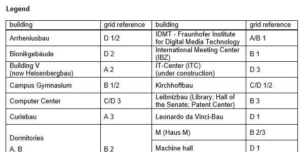
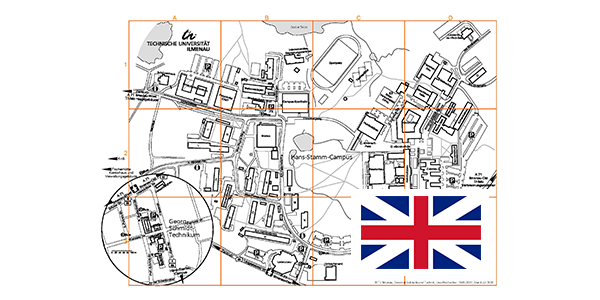
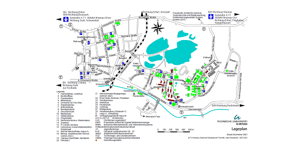
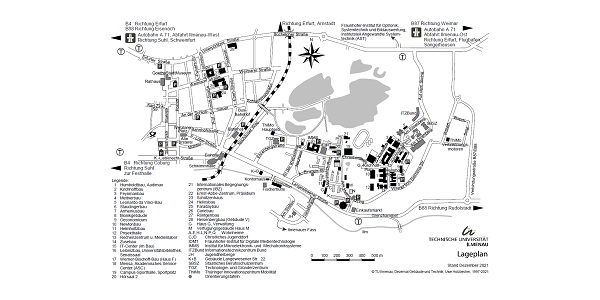
The plans with grid squares (grid), together with the legend, which is provided as a Word file, are particularly suitable for pointing out buildings, for example, as the location of structural units or a venue, without having to make changes in the graphic. These plans and the legend are also available in English.
If required, campus and site plans with special markings are produced and provided.
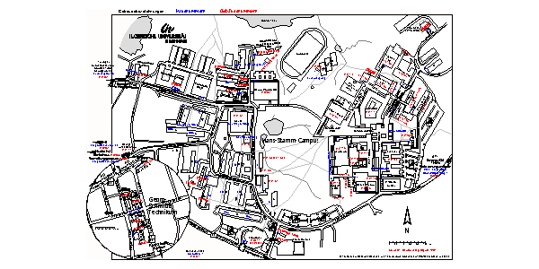
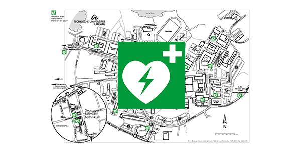
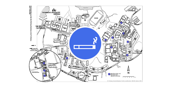
The campus plans offered here with the locations of defibrillators, smoker's islands and time recording terminals are regularly updated as they are part of service agreements.
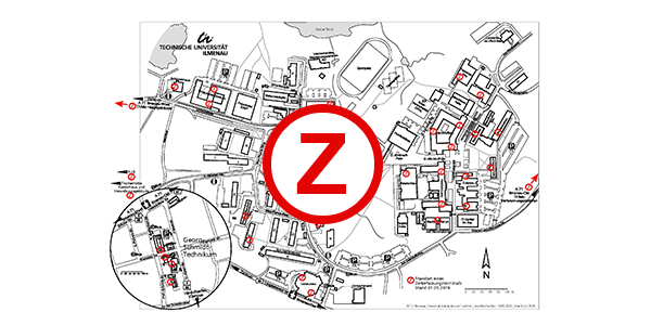
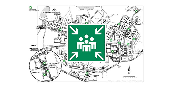
The campus map with meeting places serves as an orientation where employees, students and visitors/guests should be located in case of a necessary evacuation of a building, e.g. in case of a fire alarm.
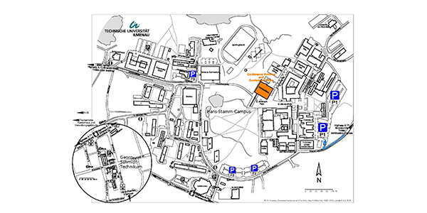
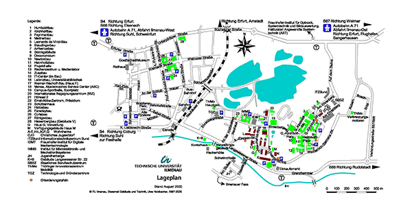
The campus map with special marking of the Humboldt Building, the guest parking spaces and partly English lettering is intended for meetings/conferences/workshops.
The campus map with information for disabled persons is intended to help them find their way around the campus. For this purpose, the location of disabled parking spaces, barrier-free access to the buildings and existing disabled toilets are shown.
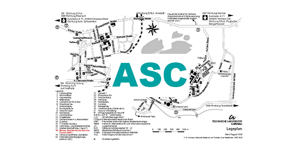
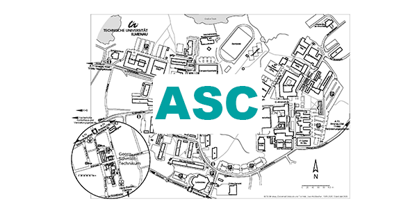
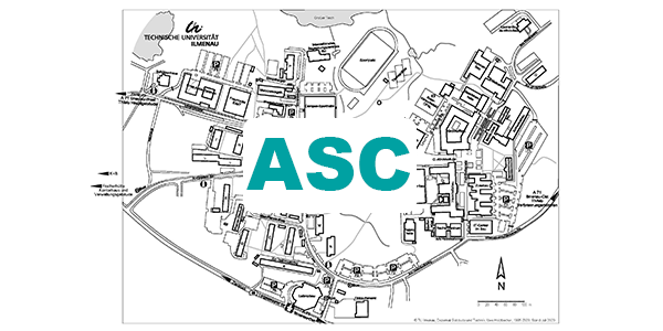
Finally, the site plan and the campus maps with special reference to the Academic Service Center (ASC) of TU ilmenau are intended to help newly arrived students find their way to their most important contact point for enrollment or re-registration.