ROADWORKS

Contact
Prof. Dr. Michael Grüning
Dekan
+49 (0)3677 69-4011
Telefax: +49 3677 69-4203
Oec (Helmholtzplatz 3) Raum 4021
Prof. Dr. Michael Grüning
Dekan
+49 (0)3677 69-4011
Telefax: +49 3677 69-4203
Oec (Helmholtzplatz 3) Raum 4021
(Duration: 2018-2021)
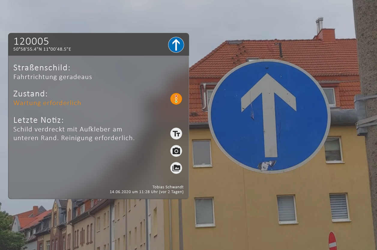
Up to now, mobile operational data acquisition during road maintenance performed using pen and paper or mobile devices like tablets or smartphones. The process of finding, rediscovering, flagging, and locating as well as performing possible follow-up checks on road and infrastructure damages is often time-consuming and cumbersome. A simple localization using GPS does not offer the necessary accuracy. It could lead to delays or, at worst, to faulty assignments. In addition to this, the use of traditional forms (pen & paper or electronic) is often error-prone when comparing the current state with previously logged data.
Augmented Realty is a promising technology that could allow a universal and location-independent localization of the user. It could also offer a user interface for data management by superimposing previously generated and stored data onto the real world. However, current algorithms in tracking and localization as well as interaction are not well suited for outdoor environments with their constantly changing properties (e.g. weather, dirt).
Aim of ROADWORKS is to develop novel algorithms for (1) outdoor-tracking for Augmented reality, (2) a context-sensitive interaction with the Augmented Reality, and (3) interfaces for remote data handling and management. Together, these solutions build the foundation for future products and services.

| Project duration: | 3 years |
| Project start: | 2018 |
| Funding body: | Thüringer Aufbaubank |